
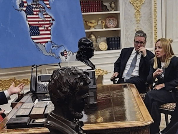
It is a photo that has obviously been digitally processed, most likely with the help of artificial intelligence. The original photo was taken in August during the visit of NATO leaders to the White House, when Trump was visited in the Oval Office by, among others, British Prime Minister Keir Starmer and French President Emmanuel Macron.
The original photo shows a standard map of the United States without any territorial changes. In the version Trump has now released, the map has been digitally altered to show Canada, Greenland, Venezuela and Cuba as part of the US.
Trump has stepped up his rhetoric on territorial issues in the Western Hemisphere in recent months. Since early January 2026, following a military operation in Venezuela in which US forces arrested President Nicolás Maduro, the Donald Trump administration has emphasized a broader strategy of strengthening US influence in the region. During that action, Trump declared that the United States “will lead the country until a safe transition of power is ensured.”
At the same time, Trump does not give up on the idea that the US should take control of Greenland, an autonomous territory of Denmark, claiming that it is crucial to US national security and that the US “must have it”. Denmark and Greenlandic officials have repeatedly rejected such claims, stressing that decisions about Greenland’s future belong exclusively to Greenlanders and Denmark.
His rhetoric toward Cuba includes messages that Havana should “make a deal” with the United States “before it’s too late.”
When it comes to Canada, Trump has repeatedly claimed that the country is completely dependent on the US economically and for security, and that, as he said, “it would make more sense as the 51st federal state.” Such statements were deemed frivolous and unacceptable by the authorities in Ottawa, and further damaged relations between the two countries, according to Canadian and American media.
(Vijesti.ba)