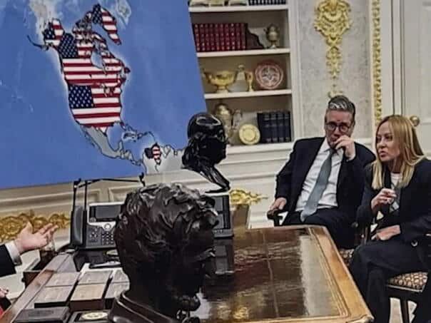
US President Donald Trump has shared an altered photo of a map of the United States showing Canada, Greenland, Venezuela and Cuba as part of US territory, Canada’s CBC reported.
It is a photograph obviously modified by artificial intelligence.
The original photo was taken in August, during the NATO leader’s visit to the White House, when Trump was visited in the Oval Office by, among others, British Prime Minister Keir Starmer and French President Emmanuel Macron, according to the CBC.
The original photo shows a standard map of the United States, without territorial changes.
In the version Trump has now shared, the map has been digitally altered to include Canada, Greenland, Venezuela and Cuba as part of the US.
(Vijesti.ba)