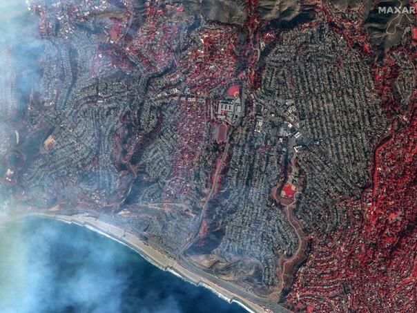
Satellite images reveal the scale of the disaster that hit Los Angeles, where the fire almost completely destroyed the Pacific Palisades area.
A new satellite photo, taken by Maxar Technologies, shows the burned areas in clear detail.
Using special wavelengths and false colors, the images allow better visualization of the damage.
The red color on the images indicates the parts of the vegetation that survived the fire, while the burned areas testify to the destructive power of the fire element.
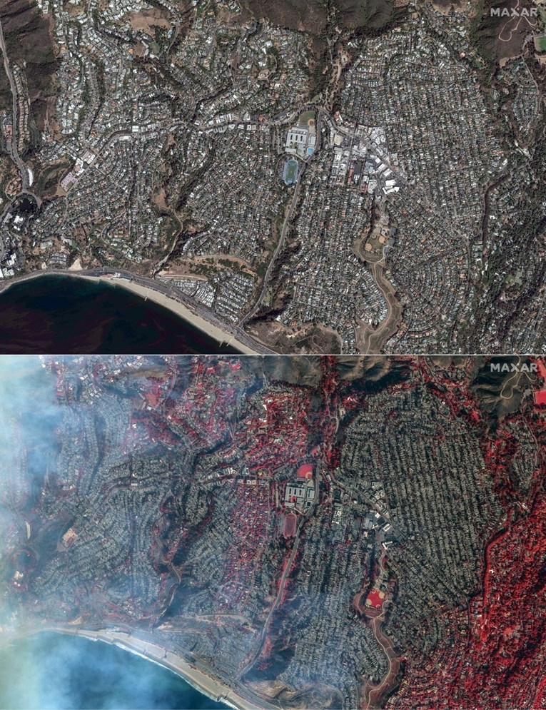
Much of the neighborhood north of Sunset Boulevard burned to the ground, including buildings near the Marquez Charter School, which was also completely destroyed.
According to the Los Angeles Times, the highest level of fire risk has been declared for a large part of the territory of Los Angeles County, which will be valid at least until Friday evening local time.
Unprecedented wildfires in the Los Angeles metropolitan area have already claimed at least five lives. The authorities fear that other bodies could be found in the burnt ruins of the building.
Death toll from California wildfires rises to 10 as the blazes spread rapidly. Martin Markovits reports on unfolding chaos from Los Angeles pic.twitter.com/l5jLeEEgHf
— TRT World Now (@TRTWorldNow) January 10, 2025
More than 130,000 residents of the Los Angeles area were ordered to evacuate. In addition to the Red Cross and other volunteer organizations, several companies offered help in the evacuation: Uber offers free transport of evacuees to safe zones, while Airbnb provides free temporary accommodation, AFP reports.
This tragedy leaves behind devastation and reminds of the dangers that communities face in such extreme situations.
(Vijesti.ba)